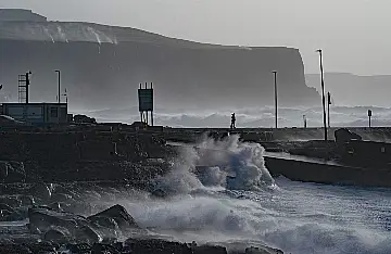
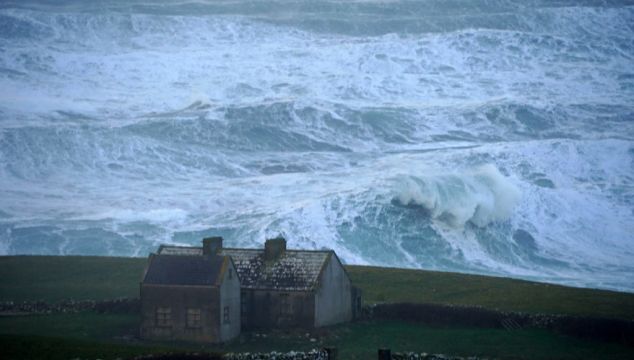
All of Ireland remains under Met Éireann weather warnings this evening as Storm Franklin crosses the island, with winds so strong that water flowing down Atlantic cliffs was instead blown skywards on Sunday.
Status-orange wind warnings are in place for six counties, while a status-yellow warning covers the island until tomorrow morning.
With Franklin the third storm to batter the island in a week, meteorologist Deirdre Lowe said parts of the country are still recovering from Storms Eunice and Dudley.
“There’s certainly a lot of structural weakness, a lot of trees were uprooted during Storm Eunice so there’s the risk of some further damage and some dangerous conditions out there,” she told Newstalk radio.
The northwest will experience stronger winds during Storm Franklin than Storm Eunice, she added.
Waterfall struggling a little bit today #stormfranklin @CarlowWeather @KildareMet @barrabest @StormHour #storm #ireland #Atlantic #belmullet @deric_tv pic.twitter.com/wZVYiXNrlg
Advertisement— johns (@johnhest2014) February 20, 2022
Gusts of up to 124 kilometres per hour were recorded at Mace Head in Co Galway, with speeds set to increase overnight.
As winds battered the Atlantic coast, local man John Heston captured a video at Dún na mBó west of Belmullet in Co Mayo, where the force of the winds was blowing a small stream back up the cliff face.
Met Éireann has said Storm Franklin will continue to cause strong to gale-force winds tonight, with “severe and damaging” gusts in the west and northwest.
These winds, combined with very high seas, will lead to wave overtopping on Atlantic coasts, which may cause coastal flooding.
There will be clear spells and frequent showers, some heavy and wintry. The showers will continue in the north and northeast through the night but will become isolated elsewhere.

Lowest temperatures of zero to four degrees will occur early on, with temperatures increasing overnight.
A status-orange wind warning is in place for Clare, Galway, Mayo, Donegal, Leitrim and Sligo, expiring at various times as the storm passes over the island.
The warning for Clare will expire at midnight, the warning for Galway and Mayo at 3am on Monday, and the warning for Donegal, Leitrim and Sligo at 7am on Monday.
Meanwhile, a status-yellow wind warning for all of Ireland will remain in force until 9am on Monday.
The UK Met Office has issued a similar warning for Northern Ireland, which will run until 1pm on Monday.
#StormFranklin: Visit https://t.co/cwxXH3X4kM for detailed up-to-date information on current outages & restoration times.
Use your MPRN (found on your electricity bill) to check the status of an outage affecting your property at https://t.co/I2p6hqmZp3. #StaySafe #StayClear pic.twitter.com/RrzWfCoR2O— ESB Networks (@ESBNetworks) February 20, 2022
Met Éireann has said Monday morning will be very windy as strong to gale-force winds continue, but they will ease through the day.
There will be a good deal of dry and bright weather in the morning and afternoon, as scattered showers in the north and east gradually die out. However, outbreaks of rain and drizzle will move into western areas during the evening.
Highest temperatures of nine to 11 degrees are forecast.
Storm Franklin comes in the aftermath of Storm Eunice, which saw thousands of homes and businesses across the country lose power over the weekend.
Tributes have been paid to a 59-year-old Wexford council worker who died after being hit by a falling tree while clearing debris from a road close to his home in Co Wexford.
Eight more deaths were recorded across Britain, Belgium and the Netherlands as Storm Eunice brought record winds of up to 196km/h and caused widespread destruction.


