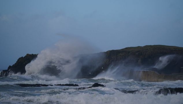
The first of two successive storms hit the country on Wednesday afternoon, with Met Éireann warning of disruptive and damaging winds as well as the potential for flooding, power outages and snow over coming days.
A status yellow wind warning associated with Storm Dudley came into place for the entire country from noon on Wednesday, until 11.30pm on Wednesday night.
During this period westerly winds were expected to reach average speeds of between 50 and 65km/h, with damaging gusts of between 80 and 110km/h.
As The Irish Times reports, the winds are expected to be stronger on exposed coasts and on high ground, while a combination of high tide and strong winds will lead to the possibility of flooding on Atlantic coasts. Power outages have already been reported across the country.
In an update to the situation on Wednesday afternoon, Met Éireann said Storm Dudley was already making its presence felt, with Donegal County Council warning of dangerous conditions at sea.
High winds are already being experienced in most coastal areas with the public advised to stay away from coastal promenades and seashores.
Met Éireann hydrometeorologist Jennifer Canavan said Ireland was “in a period of high tides at the moment and this in combination with strong winds and stormy conditions means there is a high risk of large coastal waves and coastal flooding on Friday, especially along southern and eastern coasts.
“As such we’re urging people to take extreme care near coastal areas and paths.”
A status yellow marine gale warning is in place for all coasts of Ireland and on the Irish Sea until noon on Thursday, with winds expected to reach gale force 8 or strong gale force 9.
Met Éireann said a blustery day will follow on Thursday with a mix of bright spells and some heavy showers, before cloud, rain and strengthening winds arrive ahead of the second storm, Storm Eunice.
Very windy this evening with clear spells and scattered blustery showers, some with hail and thunder in Atlantic coastal areas💨☔️⛈️
Strong to gale force southwest to west winds⚠️#StormDudley pic.twitter.com/KefzTVTX8W— Met Éireann (@MetEireann) February 16, 2022
Met Éireann meteorologist Matthew Martin said the national forecaster expected Storm Eunice to bring further challenging conditions, “especially on Friday morning as strong winds, heavy rain and snow moves across the country”.
“At the moment it looks like northern and western areas are most likely to see the heaviest snow falls, with southern areas expected to see the strongest winds, however we’re still a few days ahead and the details of when and where are likely to change,” he said.


