Authorities implored coastal residents of Texas and Louisiana to flee.
The storm grew nearly 70% in power in just 24 hours to reach Category 3 status and continued to draw energy from the warm Gulf of Mexico waters.
The system was on track to arrive late on Wednesday or early Thursday as the most powerful hurricane to strike the US so far this year.
“This is shaping up to be just a tremendous storm,” Louisiana Governor John Bel Edwards told The Weather Channel.
1 PM CDT: #Laura is now an extremely dangerous category 4 hurricane with maximum winds of 140 MPH. Little time remains to protect life and property before water levels begin to rise and winds increase in the warning areas https://t.co/tW4KeFW0gB pic.twitter.com/6f9tvionaR
Advertisement— National Hurricane Center (@NHC_Atlantic) August 26, 2020
The National Hurricane Centre kept raising its estimate of Laura’s storm surge, from 10ft just a couple of days ago to twice that size — a height that forecasters said would be especially deadly.
“Some areas, when they wake up Thursday morning, they’re not going to believe what happened,” said Stacy Stewart, a senior hurricane specialist. Whatever does not get blown down by the wind could easily be toppled by seawater pushing inland.
A Category 4 hurricane can cause damage so catastrophic that power outages may last for months in places, and wide areas could be uninhabitable for weeks or months.
The threat of such devastation posed a new disaster-relief challenge for a government already straining to deal with the coronavirus pandemic.

On Wednesday afternoon, Laura had maximum sustained winds of 125mph as it churned about 200 miles south east of Lake Charles, Louisiana, and Port Arthur, Texas, travelling north west at 16mph.
Those winds are expected to increase to 145mph before landfall, pushing water on to more than 450 miles of coast from Texas to Mississippi.
“Heed the advice of your local authorities. If they tell you to go, go! Your life depends on it today,” said Joel Cline, tropical programme coordinator at the National Weather Service. “It’s a serious day and you need to listen to them.”
On Twitter, President Donald Trump also urged coastal residents to heed local officials.
Hurricane warnings were issued from San Luis Pass, Texas, to Intracoastal City, Louisiana, and reached inland for 200 miles.
Storm surge warnings were in effect from Freeport, Texas, to the mouth of the Mississippi River.

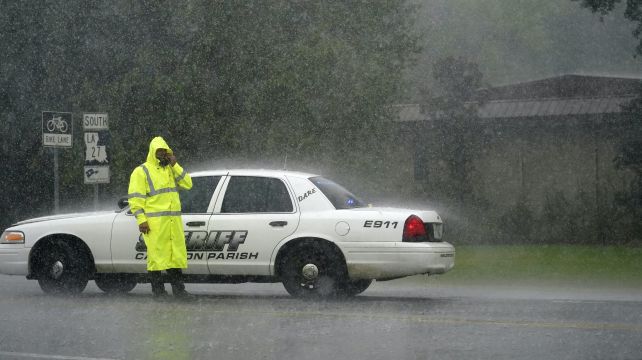
In the largest US evacuation during this pandemic era, more than half a million people were ordered to flee from their homes near the Texas-Louisiana state line, including the Texas cities of Beaumont, Galveston and Port Arthur, and the low-lying Calcasieu and Cameron parishes in south-western Louisiana, where forecasters said storm surge topped by waves could submerge entire towns.
A National Weather Service meteorologist in Lake Charles, Louisiana — in the bullseye of Laura’s projected path — took to Facebook Live to deliver an urgent warning for people living south of Interstate 10 in south-west Louisiana and south-east Texas.
“Your life will be in immediate and grave danger beginning this evening if you do not evacuate,” Donald Jones said.
Laura is expected to dump massive rainfall as it moves inland, causing widespread flash flooding in states far from the coast.
Flood watches were issued for much of Arkansas, and forecasters said heavy rainfall could arrive by Friday in parts of Missouri, Tennessee and Kentucky.
Laura is so powerful that it is expected to become a tropical storm again once it reaches the Atlantic Ocean, potentially menacing the north east.


