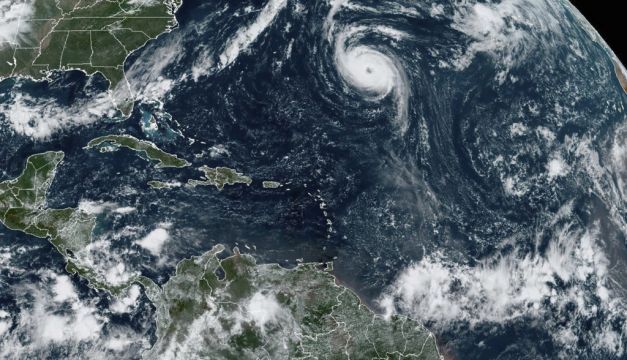
Hurricane Nigel powered up to Category 2 storm status on Tuesday afternoon and could intensify further before it starts weakening in the coming days far out over the Atlantic Ocean, the US National Hurricane Centre said.
Nigel’s top sustained winds rose to 160kph by late Tuesday, up from 145kph earlier in the day when it was a strong Category 1 hurricane.
The system was centred about 955km east of Bermuda and moving to the north-northwest at 22kph. The island territory might see swells from Nigel that could cause life-threatening surf and rip current conditions, forecasters said.
No coastal watches or warnings were in effect as the storm remained far from land.
The Miami-based hurricane centre said Nigel could strengthen some more early on Wednesday but is expected to begin weakening on Thursday and Friday and become a still strong post-tropical cyclone on Friday.
The remnants of Nigel is expected near Irish shores by the weekend with a lot of wind and rain. It will also be relatively mild. “During the hurricane season, you can quite often get the remnants of a hurricane which is carrying warm, moist air,” explained Met Éireann forecaster Andrew Doran-Sherlock.


