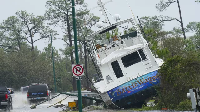
It comes as the storm’s remnants are forecast to dump as much as a 1ft of rain and spread the threat of flooding to Georgia and the Carolinas.
Coastal residents, meanwhile, looked to begin the recovery from a storm that turned streets into rivers, ripped roofs off buildings, knocked out power to hundreds of thousands and killed at least one person.

Florida Governor Ron DeSantis warned residents and visitors in flooded areas they will need to remain vigilant as water from the hurricane subsides because heavy rains to the north are expected to cause flooding in Panhandle rivers in the coming days.
“So this is kind of the initial salvo but there is going to be more that you’re going to have to contend with,” Mr DeSantis said at a news conference in Tallahassee.
In south-eastern Alabama, forecasters warned of river flooding in rural Coffee County, where the Pea River is expected to crest on Friday at a near-record 12ft above flood stage.
An alert from the emergency manager in neighbouring Pike County declared heavy rains rendered all the county’s roads and bridges impassable.
Flooding in central Georgia forced Robins Air Force Base south of Macon to close one of its entrances and delay the start of the workday for some employees.
Elsewhere in Georgia, sheriffs reported numerous trees down and some highways and streets closed because of high water.
At least one death was blamed on the hurricane.
Tony Kennon, mayor of Orange Beach, Alabama, said one person in the popular holiday destination died and another is missing as a result of the storm.
He said he could not immediately release details.
It was an unbelievably freaky right turn of a storm that none of us ever expected
Mr Kennon added the damage in Orange Beach is worse than that from Hurricane Ivan, which hit 16 years to the day earlier.
In a Facebook briefing for city residents, he said: “It was an unbelievably freaky right turn of a storm that none of us ever expected.”
Sally blew ashore near Gulf Shores, Alabama, on Wednesday morning as a major hurricane with 105mph winds.
It moved slowly, exacerbating the effect of heavy rains.
More than 2ft fell near Naval Air Station Pensacola, and nearly 3ft of water covered streets in the centre of Pensacola, the National Weather Service reported.
Floodwater swamped parked cars in the city before receding.
Sally weakened to a tropical depression late on Wednesday and picked up speed.
The National Hurricane Centre said its centre will move out of south-east Alabama and across central Georgia on Thursday, reaching South Carolina on Thursday night.
The storm has been dumping heavy rains over central and northern Georgia and western South Carolina.
The National Weather Service said up to a 1ft of rain could accumulate in parts of Georgia, where multiple flash food warnings were issued Thursday.
Forecasters said South Carolina could see isolated totals of 10 inches.
Flooding is also possible in portions of North Carolina and Virginia through Friday.
There is also a chance of tornadoes Thursday in southern Georgia and northern Florida.
More than 500,000 homes and businesses were without electricity on Thursday morning in Florida, Alabama and Georgia.

At least eight waterways in south Alabama and the Florida Panhandle are expected to hit major flood stage by Thursday.
Some of the crests could break records, submerge bridges and flood some homes, the National Weather Service warned.
The hurricane centre is tracking two other Atlantic storms.
Hurricane Teddy was strengthened to a Category 2 hurricane early on Thursday with maximum sustained winds of 105mph, it said.
It is forecast to become a major hurricane by Friday as it moves north-west towards Bermuda.
Tropical Storm Vicky is expected to dissipate in the Atlantic in the coming days.


