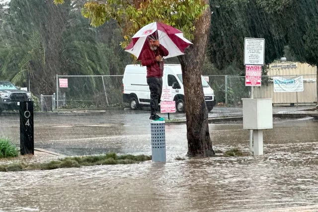
The second of back-to-back powerful storms churned through California early on Monday, flooding roadways and knocking out power for hundreds of thousands of people and prompting a rare warning for hurricane-force winds as the state braced for another day of heavy rains.
The storm inundated streets and brought down trees and electrical lines on Sunday across the San Francisco Bay Area, where winds topped 60mph (96kph) in some areas. Gusts exceeding 80mph (128kph) were recorded in the mountains.
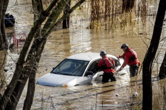
To the south in San Jose, emergency crews pulled occupants out of the windows of a car stranded by floodwaters and rescued people from a homelessness encampment alongside a rising river.
The storm then moved into Southern California, where officials warned of potentially devastating flooding and ordered evacuations for canyons that burned in recent wildfires that are at high risk for mud and debris flows.

Schools were closed across Santa Barbara County, which was devastated by mudslides caused by powerful storms in 2018.
Further down the coast, strong winds and heavy rain brought treacherous conditions to the city of Ventura.
More than 845,000 customers were without electricity across the state by Sunday evening, according to poweroutage.us.
Winds caused hours-long delays at San Francisco International Airport. By 2.30pm on Sunday, 155 departing flights were delayed and 69 had been cancelled, according to the tracking website FlightAware. There were also delays at airports in San Jose and Sacramento.
Palisades Tahoe, a ski resort about 200 miles (320km) north-east of San Francisco, said on Sunday it was anticipating the heaviest snowfall yet this season, with accumulations of 15cm per hour for a total of up to two feet (60cm). Heavy snow was expected into Monday throughout the Sierra Nevada.
Much of the state had been drying out from the system that blew in last week, causing flooding and dumping welcome snow in mountains. The latest “atmospheric river”, also called a “pineapple express” because its plume of moisture stretches back across the Pacific to near Hawaii, arrived offshore in Northern California on Saturday, when most of the state was under some sort of wind, surf or flood watch.
The weather service issued a rare “hurricane force wind warning” for the Central Coast, with wind gusts of up to 92mph (148kph) possible from the Monterey Peninsula to the northern section of San Luis Obispo County.
Meanwhile, the southern part of the state was at risk of substantial flooding beginning late Sunday because of how slow the system was moving, said Ryan Kittell, a meteorologist at the weather service’s Los Angeles-area office.
“The core of the low pressure system is very deep, and it’s moving very slowly and it’s very close to us. And that’s why we have those very strong winds. And the slow nature of it is really giving us the highest rainfall totals and the flooding risk,” he said at a Sunday briefing.

Evacuation orders and warnings were in effect for mountain and canyon areas of Monterey, Santa Barbara, Ventura and Los Angeles counties. LA county supervisor Lindsay Horvath urged residents near wildfire burn areas of Topanga and Soledad canyons to heed orders to get out ahead of possible mudslides.
The county set up shelters where evacuees could spend the night.
Governor Gavin Newsom declared a state of emergency for Los Angeles, Orange, Riverside, San Bernardino, San Diego, San Luis Obispo, Santa Barbara and Ventura counties. The Governor’s Office of Emergency Services activated its operations centre and positioned personnel and equipment in areas most at risk.
The storm was expected to move down the coast and bring heavy rain, possible flash-flooding and mountain snow to the Los Angeles area, before moving on to hammer Orange and San Diego counties on Monday.
The weather service forecast up to 20cm of rainfall across Southern California’s coastal and valley areas, with 35cm possible in the foothills and mountains. Heavy to moderate rain is expected in Southern California until Tuesday.


