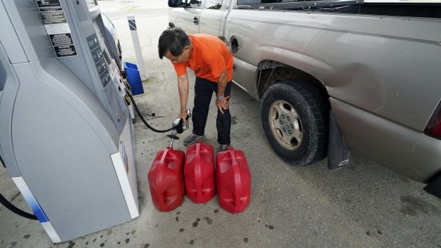
Meanwhile, tropical storm Laura is forecast to move along Cuba’s southern coast before entering the Gulf of Mexico and heading towards the same stretch of US coast later in the week, most likely as a hurricane.
The Gulf Coast braced for a history-making onslaught from the twin storms, with many evacuees recalling the damage caused by Hurricane Katrina in 2005, when catastrophic flooding hit New Orleans and as many as 1,800 people died.
“What we know is there’s going to be storm surge from Marco, we know that that water is not going to recede hardly at all before Laura hits, and so we’ve not seen this before and that’s why people need to be paying particular attention,” Louisiana governor John Bel Edwards warned at a briefing.
7AM Monday: What can we expect from Marco today? Marco is significantly weaker this morning and is located off the coast of SE LA. We still have the potential for heavy rainfall and coastal flooding/storm surge. Some gusty winds are possible along the coastal areas. #mswx #lawx pic.twitter.com/wXhUXtI03M
— NWS New Orleans (@NWSNewOrleans) August 24, 2020
Advertisement
Laura caused the deaths of at least 11 people in the Dominican Republic and Haiti, while cutting off power and causing flooding in the two nations that share the island of Hispaniola.
Marco had grown into a hurricane early on Sunday, but America’s National Hurricane Centre said its sustained winds decreased to 70mph after nightfall. The centre cautioned that Marco could still cause life-threatening storm surges and dangerous winds along the Gulf Coast.
Marco was centred about 115 miles south-southeast of the mouth of the Mississippi River land heading north-west at 10mph on Monday morning.
Laura was centred about 175 miles east-southeast of Cayo Largo on Monday morning, and had maximum sustained winds of 65mph. It was moving west-northwest at 21mph and was predicted to strengthen into a hurricane by Tuesday morning as it followed a path likely to take it to the Louisiana coast by Wednesday night, forecasters said.
🌀Storm Surge Warning remains in effect for the open coast from Morgan City to Ocean Springs. A Coastal Flood Advisory is in effect
for Lakes Pontchartrain
and Maurepas, and immediate coastal areas from Ocean Springs to the AL border. Stay tuned for updates! #lawx #mswx pic.twitter.com/MID0kBmqfoAdvertisement— NWS New Orleans (@NWSNewOrleans) August 24, 2020
In the wake of Laura’s passage through the Caribbean, authorities reported at least 11 deaths on Sunday.
Haitian civil protection officials said they had received reports a 10-year-old girl was killed when a tree fell on a home in the southern coastal town of Anse-a-Pitres, on the border with the Dominican Republic. Haiti’s prime minister said at least eight other people died and two were missing. In the Dominican Republic, relatives told reporters a collapsed wall killed a mother and her young son.
Hundreds of thousands were without power in the Dominican Republic amid heavy flooding in both countries.

Despite Marco’s weakening, a storm surge warning remained in place from Morgan City, Louisiana, to Ocean Springs, Mississippi. A tropical storm warning included Lake Pontchartrain in Louisiana, and metropolitan New Orleans.


