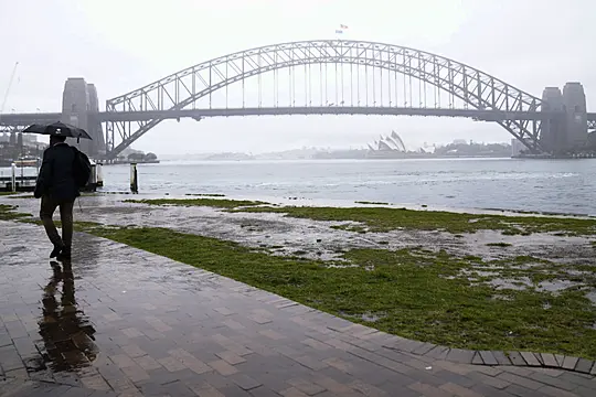
Australia’s largest city, Sydney, has been soaked by its wettest year on record with almost three months of expected above-average rain to spare.
The city of five million people beat its 1950 record of 2,194mm (86.4 inches) at 12.30pm on Thursday after 27.2mm (1.07in) of rain fell at the Observatory Hill rain gauge during the morning, Australia’s Bureau of Meteorology said. Records at Observatory Hill go back to 1859.
Heavy rain is forecast to continue across Sydney and other parts of south-east Australia, peaking on Saturday.

The Bureau of Meteorology last month said a La Nina weather pattern, which is associated with above-average rainfall in eastern Australia, was under way in the Pacific.
The bureau forecast that the La Nina event may peak during the current Southern Hemisphere spring and return to neutral conditions early next year.
La Nina is the cooler flipside of the better-known drying El Nino pattern. La Nina occurs when equatorial trade winds become stronger, changing ocean surface currents and drawing up cooler deep water.
It is the third La Nina since 2019 became Australia’s hottest and driest year on record.
That year came to a catastrophic conclusion with wildfires fuelled by drought that directly or indirectly killed more than 400 people, destroyed more than 3,000 homes and razed 19 million hectares (47 million acres) of woods, farmland and city fringes.

Sydney was among several south-east Australian cities that were shrouded in acrid wildfire smoke during the Southern Hemisphere summer of 2019-20.
Sydney had its wettest July on record this year after only two weeks, passing the 1950 record of 336.1mm (13.2in) on the way to a total of 404mm (15.9in).
March broke a 1942 record of 521.4mm (20.5in) when 554mm (21.8in) of rain fell.
The ongoing deluge will see rivers in New South Wales state swollen by moderate-to-major flooding, affecting towns including Tamworth, Dubbo and Bathurst, authorities said.


