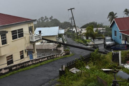
Conditions in southern Florida have begun to deteriorate as Tropical Storm Elsa takes aim at the Florida Keys, prompting a hurricane watch for portions of the west coast of the state, according to the National Hurricane Centre.
In addition to damaging winds and heavy rains, the Miami-based centre said the peninsula is in danger of life-threatening storm surges, flooding and isolated tornadoes.
A hurricane watch was issued for the west-central and Big Bend coast of Florida from Egmont Key to the Steinhatchee River.
Here are the 5AM EDT July 6 Tropical Storm #Elsa Key Messages. A Hurricane Watch has been issued for a portion of the west-central and Big Bend coast of Florida. More details: https://t.co/905zOAYiId pic.twitter.com/kt39uuW3de
— National Hurricane Center (@NHC_Atlantic) July 6, 2021
Advertisement
About 3in to 5in of rainfall with localised maximums up to 8in are expected through Wednesday across the Keys and into south-west and western portions of the Florida peninsula.
A few tornadoes are possible across south Florida on Tuesday and across the peninsula later in the day, the centre forecasted.
State governor Ron DeSantis on Monday expanded a state of emergency to cover a dozen counties that span an area of Florida where Elsa is expected to make a swift passage on Wednesday, and President Joe Biden approved an emergency declaration for the state ahead of the storm.
We are continuing to closely monitor #Elsa. All Floridians should prepare for the possibility of heavy rain, flooding and potential power outages. Now is the time to restock your supplies and review your hurricane plan. Follow @FLSERT for updates throughout the coming days. pic.twitter.com/C4lzmK3R50
— Ron DeSantis (@GovRonDeSantis) July 4, 2021
Advertisement
A ramped-up rescue effort at the collapsed south Florida apartment building faced new threats from the weather as the tropical storm approached the state.
On Monday, lightning forced crews to pause the search for victims of the June 24 collapse in Surfside and a garage area in the rubble filled with water, officials said.

Elsa’s maximum sustained winds strengthened to 60mph early on Tuesday. A slow strengthening is forecast through Tuesday night and Elsa could be near hurricane strength before it makes landfall in Florida. It is expected to weaken after it moves inland.
Elsa made landfall in Cuba on Monday afternoon near Cienega de Zapata, a natural park with few inhabitants. It headed north-westward across the island, passing Havana just to the east.
Rainfall of 5in to 10in with isolated maximums of 15in are expected on Tuesday across portions of Cuba which will result in significant flash flooding and mudslides.
There were no early reports of serious damage as Elsa passed over Cuba.

Elsa spent Sunday and much of Monday sweeping parallel to Cuba’s southern coast before heading on to land, sparing most of the island from significant effects.
As a precaution, Cuban officials had evacuated 180,000 people against the possibility of heavy flooding from a storm that had already battered several Caribbean islands, killing at least three people.
Tropical storm warnings were posted for the Florida Keys from Craig Key westward to the Dry Tortugas and for the west coast of Florida from Flamingo northwards to the Ochlockonee River.
A tropical storm watch has also been issued for the Georgia coast and portions of the South Carolina coast from the Mouth of St Marys River to South Santee River, South Carolina.

Tropical storm conditions should continue over portions of central and western Cuba during the next several hours. Tropical storm conditions are beginning in the warning area in the Florida Keys and are expected along the Florida west coast later on Tuesday.
Elsa was the first hurricane of the Atlantic season until Saturday morning and caused widespread damage on several eastern Caribbean islands on Friday.
As a tropical storm, it resulted in the deaths of one person on St Lucia and a 15-year-old boy and a 75-year-old woman in the Dominican Republic.


